Precise Aerial Data
Stunning Digital Media
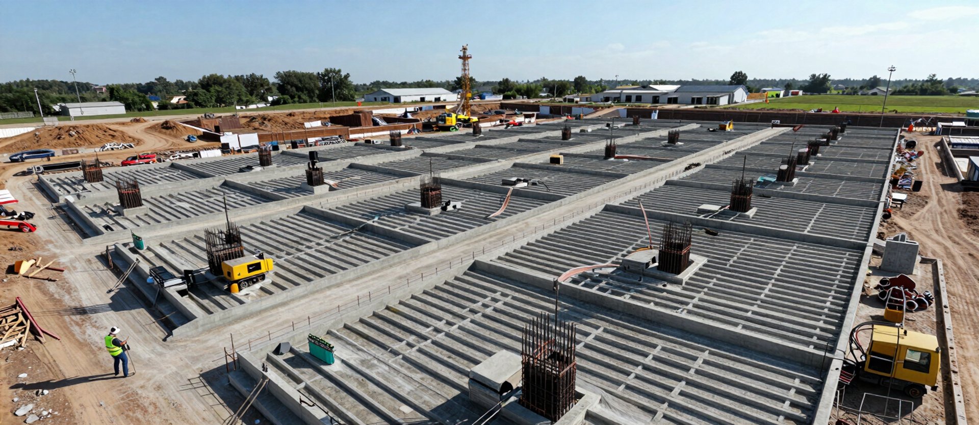
Aerial photography, videography, orthography, and 3D mapping, catering to real estate experts, the construction and agriculture sectors, community gatherings, marketing initiatives, media, and life events.
Part 107 Certified Drone Pilot flying construction, agriculture, real estate, and events. Veteran owned and operated.
Proof of work across every job type
From weekly site-condition flights on active builds to acreage surveys and event documentation — we cover the jobs where accuracy is non-negotiable.


Instagram Feed
Real jobs. Real feedback.
They flew our site every Monday for twelve weeks. The mapping data let us catch a grading error before the pour — saved us two days of rework.
The acreage survey came back before noon. I had the boundary data loaded into our planning software same afternoon — no waiting, no back-and-forth.
Used them for three property listings in a row. Buyers commented on the overhead shots in every showing. Files ready before I got back to the office.
Marcus T. — Construction Project Manager
Dana R. — Agricultural Consultant
Priya S. — Real Estate Agent
Pages
Home
Services
Portfolio
About
Contact
Get on the schedule
Available Mon–Sat
Serving South Central Pennsylvania and surrounding areas.
(C) 2026 Dad and Dude Drone Ops, LLC
Dad and Dude Drone Ops offers technological solutions and services for capturing aerial data. Dad and Dude Drone Ops is not a licensed engineering or land surveying firm and does not employ licensed professional engineers or land surveyors. All information on this website, including text, graphics, images, and other materials, is meant for general informational purposes only. This information is not suitable for any specific context or situation. It does not serve as a replacement for licensed professional engineering or land surveying services, nor is it an offer to provide such services.
Privacy Policy
Terms & Conditions


Fully Licensed and Insured