Wide overhead orthographic frame of an active construction site — concrete foundations and steel framing mid-pour, heavy equipment casting long shadows, natural midday light, no people visible, documentary framing from directly above
— Construction & Mapping

Site data your crew can act on

Three years on active job sites means we know which angles, formats, and flight schedules keep your superintendent moving. Ortho maps and point clouds delivered same day.

/ What we deliver

Formats your software expects

2D Orthographic Maps

3D Point Clouds

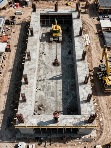
Weekly Progress Documentation

Georeferenced GeoTIFF and DXF outputs compatible with AutoCAD, Procore, and most project management platforms. Centimeter-level accuracy per flight.

LAS and PLY point cloud exports ready for Revit, Civil 3D, or ReCap. Volume calculations and cut-fill analysis included on request.

Scheduled flights capture dated site conditions for owner reporting, dispute documentation, and milestone sign-off. Files transferred same day.

Close-up orthographic mapping output displayed on a ruggedized tablet propped on a job-site surface, color-coded elevation layers visible on screen, concrete forms and rebar visible in background, natural daylight, no people
Wide-angle overhead drone frame of an active construction site mid-phase — graded earthworks, foundation grid, and equipment tracks visible from directly above, golden-hour natural light raking low across the site, no people, documentary framing
Precision mapping output

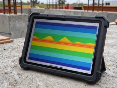
Readable on site, not just in the office

Every deliverable is checked against ground control points before transfer. If the accuracy falls short, we fly again — no extra charge.

Flight schedule & cadence

Weekly flights, zero coordination overhead

We set the recurring schedule at project kickoff. Your team gets a file drop notification — no follow-up calls, no delays, no data gaps in the project record.

Put us on your weekly flight schedule

Tell us the site, the start date, and the output format. We handle the rest from first flight to final file.